


MARS BIBLE — REFERENCE GUIDE
Inertial, stellar and optical navigation: locating yourself when Mars has no GPS
IMU, stars, cameras, orbital maps, visual odometry and sensor fusion: build robust navigation without relying on one reference.


Getting lost on Mars is not a metaphor
On Earth a phone can obtain position in seconds from GNSS constellations, maps and networks. A Mars crew cannot assume that infrastructure exists. A rover going behind a ridge needs its position, attitude, energy reserve, return path and the uncertainty attached to all of them. Tens of metres may be irrelevant on a flat plain and critical near a cliff, exclusion zone or emergency cache.
Martian navigation is therefore a sensor-fusion problem. No instrument reports “truth” by itself. An inertial unit gives immediate motion information but drifts. Stars provide an absolute attitude reference but not complete surface position. Cameras can recognize terrain but suffer from dust, lighting and texture. Radio can measure range or relative velocity depending on geometry.
Robustness comes from combining imperfect measurements whose errors are not identical. Diversity reduces common failure, but fusion demands common reference frames, coherent clocks and honest uncertainty models.
The central question is not simply “where am I?” It is “where does the system believe it is, with what uncertainty, based on which measurements, and what can it still do without exceeding safety margins?”
Navigation error costs time and energy and can become a survival problem. In a landscape without continuous roads, a few kilometres of unexpected detour may consume a rover reserve or put an EVA crew too far from shelter. Navigation therefore needs more than a dot on a map: position, uncertainty, terrain state, retreat route and shared references with other vehicles.
The map itself is never perfectly true. Dunes move, dust obscures detail, shadows change and human operations modify the site. A settlement will have to continuously reconcile orbital mapping, local observations and surveyed reference points, much as a terrestrial city maintains its maps and buried networks.
Scenario: a rover loses the link and discovers that position is a probability
Imagine an autonomous rover 80 km from the base. The last orbital correction was three hours ago. The IMU continues measuring acceleration and rotation, but a small bias error accumulates. Visual odometry compares terrain between images, but a bland dusty area provides fewer features. An orbital map supplies a more absolute reference if the rover can recognize landmarks.
The system therefore does not have one perfect “position”; it has an estimate accompanied by covariance, a mathematical representation of uncertainty. As uncertainty grows, the rover can slow down, seek a beacon, climb to a location with better sky visibility or wait for an orbital pass. Intelligent autonomy begins by recognizing when navigation quality is degrading.
Safety depends on integrity as much as accuracy
A 20 m error may be acceptable on an open plain and catastrophic beside a cliff, power cable or habitat interface. Navigation therefore needs to report not only position but confidence and how quickly a bad solution can be detected. Integrity becomes essential when vehicles operate near people or share constrained corridors.
Different sensors fail in different reference frames
An inertial unit propagates motion continuously but accumulates bias and drift. A star tracker can provide an external attitude reference yet may be blinded by Sun geometry, plume light or contamination. Optical navigation can constrain line of sight to a planet, moon or terrain feature, but its accuracy depends on image geometry and feature knowledge. Combining these sensors works because their error mechanisms are different. The estimator should therefore preserve residuals and health information rather than blending every input into one opaque state. During a long Mars transfer, occasional absolute observations can bound inertial drift; near the surface, terrain or landmark measurements can update position while inertial data bridges periods when images are unavailable.
Calibration is part of navigation state knowledge
Bias estimates, alignment matrices and camera geometry change the meaning of raw measurements. A sensor that is electrically healthy can still degrade navigation if its calibration is stale after a thermal cycle or mechanical intervention. Long missions therefore preserve calibration history and test opportunities, allowing the estimator to separate a changed environment from a changed instrument.
Inertial navigation: knowing immediately how you move, then accepting drift
An IMU mainly measures acceleration and rotation. Integrating those measurements reconstructs velocity, attitude and position. The advantage is independence from external transmitters. The fundamental weakness is that small bias becomes large error when integrated.
Consider a pedagogical constant acceleration error of 0.001 m/s². After 100 s it creates 0.1 m/s of velocity error. Position error from a constant acceleration is roughly ½at²: 0.5 × 0.001 × 100² = 5 m. After 1,000 s the same uncorrected bias would imply about 500 m. Real systems are far more sophisticated, but the order of magnitude explains the need for external references.
Gyroscopes and accelerometers have noise, bias, scale factor, misalignment and thermal dependencies. Serious navigation does not hide them in one accuracy number. It propagates covariance or another uncertainty representation so guidance knows whether position is precise or merely plausible.
At Mars inertial navigation will remain a backbone for vehicles, aircraft, landers and robots. It is available everywhere, but it must be periodically constrained by observations of the outside world.
An inertial unit measures acceleration and rotation at high rate without any external infrastructure. It keeps working through radio outages, dust or tunnels. The price is drift: tiny biases are integrated into velocity and then position. A simplified constant acceleration bias of 0.001 m/s² produces roughly 5 m of position error after 100 s and 500 m after 1,000 s if nothing corrects it.
Real navigation therefore combines inertial continuity with periodic absolute corrections from stars, terrain, radio or beacons. Thermal calibration, mechanical alignment and bias modeling can matter as much as the headline sensor specification.
The Martian environment complicates calibration. Sensors do not live at constant temperature: a rover can move between very cold periods and locally warm electronics. Gyroscope and accelerometer biases can change with temperature. Serious designs therefore combine calibration tables, thermal measurements, re-alignment procedures and drift monitoring. A terrestrial data-sheet number is never a guaranteed performance across every Martian operating phase.
Inertial redundancy also raises the question of dissimilarity. Three identical units can vote through an isolated failure while remaining vulnerable to the same software defect, aging mechanism or environmental sensitivity. Critical functions can benefit from combining different sensing principles so a common cause cannot mislead every path in the same way.
Stars, Sun and horizon: recovering absolute references
A star tracker photographs the sky, recognizes stellar patterns and provides absolute attitude against a catalogue. In interplanetary space this is central because stars offer a highly stable reference. Surface use is different, but the principle remains valuable for selected platforms.
Optical navigation can also use the Sun, Phobos, Deimos, Mars itself or other known bodies. During cruise, line-of-sight measurements constrain spacecraft state. Near Mars, the planetary limb, stars and surface imagery add information.
A navigation camera is not simply “a camera with AI.” It becomes a geometric instrument when its calibration, focal length, orientation, timing and observed-object geometry are known. A beautiful image without calibration can be nearly useless for navigation.
A settlement therefore benefits from local calibration facilities, camera models and catalogues. Optical metrology becomes navigation infrastructure as well as scientific infrastructure.
A star tracker matches observed star patterns against a catalogue and can provide a highly accurate attitude reference. It is powerful in space or with clear sky but can be affected by the Sun, occultation, dust or field-of-view constraints. Sun sensors, horizon references and other cues can complement it.
Attitude directly affects surface operations. A few degrees of error can mispoint a high-gain antenna, distort map projection or change how a slope is interpreted. That is why position, attitude and time are normally estimated together rather than treated as unrelated instrument readings.
Recognizing the ground: visual odometry, orbital maps and terrain-relative navigation
Mars rovers have demonstrated visual odometry: comparing successive images estimates motion when wheels slip and mechanical odometry is uncertain. Perseverance added faster autonomous navigation, while Mars 2020 descent used terrain-relative navigation to compare surface imagery with an onboard map in real time.
The principle extends beyond landing. A base can maintain multi-layer maps containing terrain, hazards, roads, beacons, soil properties and radio coverage. Vehicles compare what they see with that reference while accepting that the map ages as construction moves regolith or new modules hide landmarks.
Navigation becomes configuration management. Which map version does the rover use? Does operations have the same one? Is a road still open? Was a moved beacon declared? Geospatial data deserve the same configuration discipline as software.
At city scale a living map becomes a shared asset connecting navigation, science, logistics, emergency response, urban planning and resource extraction.
Visual odometry tracks features between successive images to estimate motion and can correct the false distance suggested by wheels that slip in sand or over obstacles. At larger scale, comparison with orbital maps can re-anchor the route. Terrain-relative navigation during landing follows the same family of ideas: recognize what the camera sees and compare it with onboard knowledge of the world.
A city could extend this with ultra-high-resolution local maps, maintained landmarks, radio beacons and continuously updated 3-D models. Navigation becomes a shared asset: each rover improves the map used by the next. That collective memory is especially valuable where a localization mistake cannot be fixed by calling nearby roadside assistance.
Vision has its own failure regimes: uniform terrain with little texture, long shadows, dust on optics, low Sun, image compression or seasonal changes. Autonomous navigation should detect when images no longer contain enough trustworthy information rather than force a match. The camera must not only produce an answer; it must help quantify when that answer is weak.
Human operations also need richer maps than elevation alone. Traversable slopes, deep-dust zones, access to shelters, radio coverage, energy cost and EVA risk can become layers in the same route graph. The geometrically shortest path is not necessarily the safest path.
Filtering uncertainty: the Kalman idea without turning the chapter into a mathematics course
A Kalman filter and its many relatives implement an intuitive loop: predict state with a model, observe the world, compare prediction and measurement, then correct according to uncertainty. If inertial data are temporarily good but a camera is blinded by dust, the two sources should not receive equal weight. When the camera finds strong landmarks again, it can constrain drift.
The “state” contains quantities the system needs: position, velocity, attitude, sensor bias and sometimes other parameters. Covariance describes confidence and correlated errors. This is operationally important: a position known to ten metres is not the same object as a point whose uncertainty is half a kilometre.
Filters can fail when models are wrong or sensor faults are not represented. Innovation checks, anomaly detection and measurement rejection are therefore part of navigation. Sensor fusion is not a democracy where the majority is always correct.
Human interfaces should display uncertainty instead of a falsely precise dot. Ellipses, bands and confidence levels communicate what the system truly knows.
A Kalman filter does not magically discover the true position. It maintains an estimate and a description of uncertainty. Model propagation normally increases that uncertainty; a trusted measurement can reduce it. A noisy sensor receives less weight than a precise one. Covariance is the language used to describe this confidence and the relationships among errors.
Operationally, two vehicles can display the same estimated position but have very different navigation quality. One may be confident to metres and the other only to hundreds of metres. Speed limits, obstacle clearance and decisions to continue or stop should therefore depend on uncertainty, not only on the best estimate.
The Kalman idea: combine imperfect measurements because they are imperfect in different ways
An inertial sensor responds immediately but drifts. Terrain observations can be absolute but intermittent. A radio measurement may be strong in one geometry and weak in another. Kalman filters and related estimators exploit that complementarity: they propagate a model of vehicle state, then correct the estimate when new measurements arrive according to their uncertainty.
The important lesson is not matrix algebra. It is discipline: a measurement has both a value and a quality. If a radio position looks extremely precise but conflicts violently with inertial history, the system should question the sensor, timing or beacon identity before instantly jumping to the new solution.
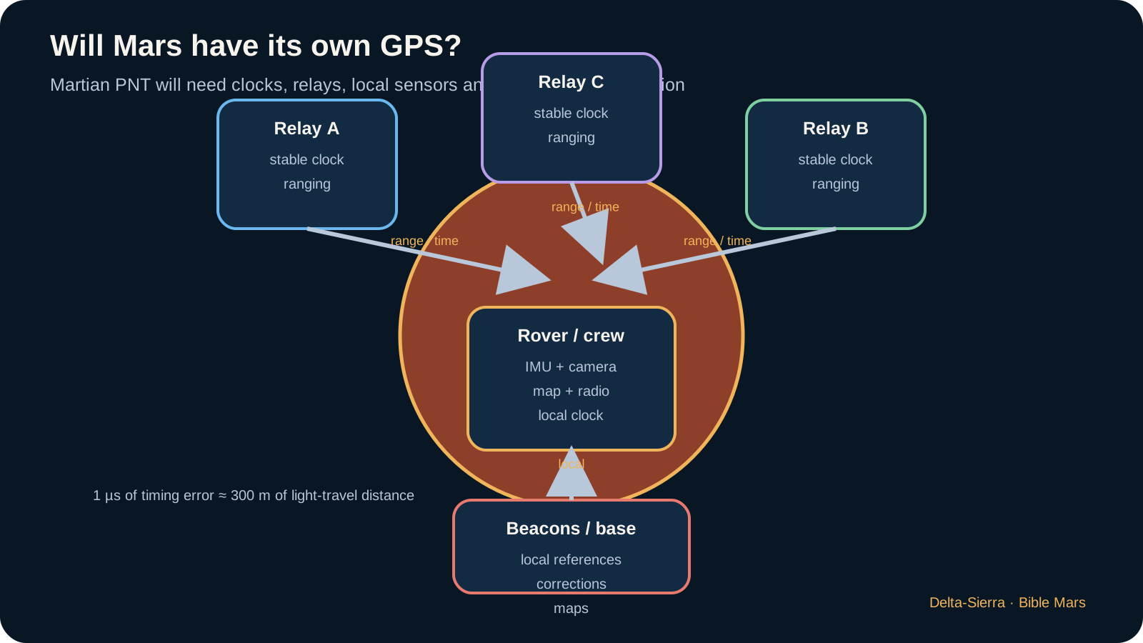
Toward Martian PNT: from orbital relays to neighborhood beacons
The JPL PNT study argues that dedicated Mars services should be designed well ahead of large-scale human operations. Orbiters could distribute time and ephemeris information; surface beacons would strengthen accuracy around bases; vehicles would combine those signals with inertial and vision systems. The architecture can grow incrementally.
A first outpost may not need a planet-wide constellation. Carefully surveyed local control points, a few beacons and orbital relays can transform operations around one site. As settlements multiply, reference frames and timing services must be tied together.
Ownership and interoperability then matter. If each agency or company deploys incompatible beacons, users carry multiple receivers and emergency operations become brittle. International standards can prevent navigation infrastructure from fragmenting into closed islands.
Mars will therefore likely need a PNT system of systems rather than a copy of GPS. The goal is familiar — position, velocity and time — but distances, deployment history and user population are different.
A first Martian PNT service need not wait for a full constellation. A few orbiters with stable clocks and ranging capability, combined with local beacons and maps, would already improve autonomy. A permanent base could install surveyed geodetic points and reference stations around its operational zone.
As multiple settlements appear, compatible reference frames become strategic. Two cities should not describe the same location with incompatible coordinates or use time scales that cannot be converted reliably. Geodesy, timing and navigation-message standards eventually become institutional infrastructure as much as engineering detail.
A “Martian GPS” does not need to copy Earth’s satellite count
Terrestrial GPS is the result of a particular architecture: a large constellation, orbits selected for global coverage, atomic clocks, control stations, navigation messages and receivers that solve position from several signals. Mars has a different size, rotation period, user population and economy. Copying the number of satellites without copying the reasoning would be a design error.
An early base could use a regional system: a few orbital relays provide timing and radiometric measurements, local beacons cover work areas, rovers combine inertial sensing with vision, and orbital maps provide references. As settlements grow, the architecture can become planetary. The service definition matters more than the label: required accuracy, availability, integrity, coverage and time to alert when a solution becomes unsafe.
PNT can share telecommunications infrastructure
An orbiter already providing communications knows its orbit, carries a clock and transmits signals. It can contribute to navigation if messages, synchronization and geometry are designed for that function. The convergence is attractive because one spacecraft can provide communications, time distribution and ranging or Doppler observables. It also creates common-mode dependency: a constellation failure can remove several services at once.
A resilient Mars architecture therefore needs independent sources: onboard inertial navigation, stars, terrain, local beacons and perhaps vehicle-to-vehicle relative navigation. The correct choice is not “GPS or nothing,” but fusion of systems that fail differently.
What happens when sensors disagree?
A dangerous navigation failure is not always a black screen. Hard cases occur when several sensors still report plausible but incompatible numbers: an IMU drifts, a camera matches the wrong terrain, a radio beacon moves or time is wrong. The system must detect inconsistency before it becomes a bad trajectory.
Redundancy therefore needs diversity. Three identical sensors sharing one software or thermal failure may be less safe than independent inertial, optical and radio measurements. Cross-checks compare domains: visual velocity against inertial dynamics, radio range against the map and stellar attitude against vehicle motion.
In degraded mode the mission objective changes. A rover can slow down, avoid difficult terrain, return to a beacon or stop. A lander may not be able to stop and must choose a safe solution in the time remaining. Navigation must state what it can still guarantee.
A mature settlement preserves sensor logs and map versions so anomalies can be reconstructed. Navigation becomes a safety system and technical memory rather than just a number on a display.
A contradictory sensor is often harder than a dead sensor because it can continue producing plausible but wrong values. An IMU drifts, a camera matches the wrong feature or a radio beacon carries bias. FDIR must detect inconsistency, isolate the suspected source and reconfigure the estimate without triggering a cascade of bad decisions.
The vehicle must also know when to admit uncertainty. Slowing down, stopping, returning to known terrain or requesting local validation may be safer than continuing with exploding covariance. Safe navigation is not merely accurate; it has defined behavior when accuracy can no longer be demonstrated.
A decision tree can handle several degrees of disagreement. Small camera-versus-inertial divergence can increase uncertainty and trigger a search for another reference. Larger disagreement can reduce speed. Loss of several absolute references can cause a return toward a known beacon. Graduated behavior prevents a small discrepancy from causing a hard stop while also preventing silent drift.
After an incident, raw sensor data, software versions, temperatures, image quality and estimator decisions should remain available for diagnosis. In a settlement, that analysis can improve maps, procedures and maintenance criteria for every other vehicle.
Will Mars have GPS? The wrong question opens the right chapter
Terrestrial GPS works because satellites occupy known orbits, carry stable clocks and transmit synchronized signals. A receiver measures propagation times and solves for position using multiple sources. Copying the terrestrial constellation around Mars may be neither necessary nor economical. Settlement geography, user density, existing telecom relays and coverage requirements will be different.
An early base may combine local beacons, inertial navigation, terrain imagery and occasional orbital ranging. A region with hundreds of active vehicles may justify a broader PNT service. The same orbiters carrying communications can contribute time, Doppler and range measurements. The better question is therefore: what accuracy and availability does each operation require? A mining truck and a human lander do not have the same navigation risk.
JPL work on PNT architectures for the Moon and Mars emphasizes that Mars should not simply inherit a lunar design. Orbits, autonomy, coverage and clock technology shape the architecture. A future constellation could merge communications, positioning and timing rather than reproduce GPS as a separate system.
For society, position is a public-safety service. It enables rescue, convoy coordination, industrial asset tracking, grid synchronization and scientific georeferencing. PNT is therefore invisible infrastructure connecting mobility, safety, industry and science.
Inertial navigation is autonomous, but error integrates
An inertial measurement unit senses acceleration and rotation without relying on external signals. That makes it extraordinarily valuable during outages. But it integrates imperfect measurements. A small bias becomes a velocity error and then a growing position error, so inertial navigation is powerful in the short term and must be corrected over longer periods.
Consider a constant acceleration bias of only 0.001 m/s². In a simplified one-dimensional case, position error is approximately Δx = ½ a t². After 100 seconds the error is 5 metres. After 1,000 seconds it is 500 metres. Real systems are more complex, but the example explains immediately why external observations matter.
Star trackers provide a strong attitude reference. Cameras can recognize terrain or horizons. Radio provides range and radial velocity. Wheel odometry works until wheels slip. No sensor is universally best, so modern navigation fuses independent information and carries an explicit estimate of uncertainty.
Kalman filtering is one classic framework for that fusion. It combines a motion model with measurements according to uncertainty. Covariance tells the system how much confidence it should place in its estimate and which directions remain poorly observed. A rover that knows its uncertainty can slow down or request another observation before uncertainty becomes danger.
Optical navigation: Mars itself becomes a beacon
Cameras can turn the landscape into navigation infrastructure. Visual odometry estimates motion from successive images; terrain-relative navigation compares observed features with onboard maps; deep-space optical navigation can use planets, moons and stars.
The attraction is obvious: the environment itself supplies information. The limitations are equally important. Lighting changes, dust obscures landmarks, featureless terrain weakens matching, and maps can become stale. Software must know when images no longer constrain the state well enough.
For a city, maps become critical operational data. New roads, excavation, dune migration or a collapsed slope changes the world that autonomy expects. Mapping becomes a continuously updated civic service rather than a static science product.
Orbital PNT, local beacons, inertial sensors and optical methods can therefore reinforce one another. A robust settlement is unlikely to trust a single constellation; it will use an architecture whose source of truth changes with location, mission and failure state.
From terrestrial GPS to Martian PNT: copying Earth would be a mistake
GPS feels simple to users because its complexity is buried inside infrastructure. Satellites know their orbits and time very accurately; a receiver compares the arrival of several signals and solves for position and clock error. Mars has no equivalent global constellation. More importantly, it would be careless to conclude that Mars merely needs “twenty-four GPS satellites.” Planet size, useful orbits, available mass, early demand, communications requirements and maintenance economics are different from Earth.
An early settlement can therefore build PNT in layers. Telecommunications orbiters can provide radio measurements and time references; local beacons can cover work zones; vehicles fuse inertial sensing, cameras, terrain and radio; critical systems share trusted time. The first service may be regional and imperfect. As population and mobility grow, the same telecommunications assets can increasingly be designed to provide navigation services as well.
Why four visible satellites do not tell the whole story
Accuracy depends on geometry as well as number. Four signals clustered in one part of the sky produce a more fragile solution than signals distributed around the receiver. A Martian service must therefore consider geometric dilution, terrain masking, orbital visibility and clocks. In a canyon or below a crater rim, ground beacons or optical navigation may matter more than a distant orbiter.
The city itself eventually becomes a beacon. Roads, buildings, towers, landing pads and geodetic reference points can be mapped with improving precision. A rover no longer depends on a single technology: it recognizes terrain, measures its own motion, receives radio signals and compares its state with a shared map.
Clock error, distance error, authority error
A propagation measurement turns time into distance. One microsecond — 10⁻⁶ second — corresponds to roughly 300 meters of light travel. That does not mean every clock error of one microsecond automatically creates 300 meters of position error in a real navigation system; architectures combine measurements, models and calibrations. The scale nevertheless shows why synchronization is infrastructure rather than an IT detail.
The issue becomes even more important for autonomy. A position is not simply “true” or “false”; it carries uncertainty. A vehicle that knows its state to ±0.5 m may accept a narrow maneuver. If uncertainty grows to ±50 m, the same command should be rejected or replaced with a safer strategy. Navigation quality therefore becomes a direct limit on authority.
From inertial sensing to optics: fuse sensors that fail differently
An IMU provides fast rotation and acceleration measurements, but small biases integrate over time. A camera can re-anchor the vehicle to terrain, but dust, lighting or repetitive landscapes can confuse it. Radio can provide range or Doppler, but only when useful transmitters are visible. Stars offer an extraordinary absolute reference, but star trackers are not useful in every dynamic phase. Robust architecture therefore does not seek a perfect sensor; it combines sensors whose weaknesses differ.
The estimator then maintains two products: its best state estimate and a representation of uncertainty. Covariance is not mathematical decoration. It tells the system whether the solution is good enough to enter a corridor, approach an airlock, guide a drone or start a landing phase. When sensors disagree, the system should not arbitrarily choose the one that “looks right”; it should evaluate their histories, error models, residuals and context.
For a settlement, sensor fusion enables distributed navigation. A rover can operate for hours without outside infrastructure, then use a base beacon to recalibrate. An orbiter can provide a less frequent but independent measurement. A common map can be improved by many vehicles. Autonomy therefore does not mean isolation: it means continuing when each external service disappears, while exploiting those services whenever they return.
Position is not enough: the system must know how trustworthy the position is
Navigation produces an estimate, not a perfect coordinate. A state estimator therefore needs uncertainty as well as position and velocity. Covariance is the mathematical language used to describe how uncertain the estimate is and how errors in different state variables relate. A rover that reports “I am here” without an uncertainty bound is less useful than one that reports “I am here, with this error ellipse, and the uncertainty is growing in this direction.”
This becomes operationally important near hazards, airlocks, landing zones and other vehicles. An autonomous system may need to stop not because its estimated position is outside the safe corridor, but because the uncertainty has grown until the corridor can no longer be guaranteed. Navigation integrity is therefore the ability to know when the solution should not be trusted.
A Martian PNT service can grow incrementally instead of appearing as a full GPS clone
The first crews may navigate with inertial sensors, stars, terrain maps, radio ranging and orbital assets that were never designed as a global navigation constellation. Later relays could carry increasingly precise clocks and navigation payloads. Local beacons may protect the most safety-critical zones. Only when demand and economics justify it might the system evolve toward persistent regional or global PNT.
This staged path matters because Mars does not need to copy the exact terrestrial GPS constellation. Orbital geometry, user density, settlement location, required accuracy and the possibility of combining telecom and navigation payloads create different trade spaces. A mining district may need centimetre-scale local relative positioning while a cargo convoy hundreds of kilometres away may accept much larger errors.
The lost-rover problem is a lesson in sensor fusion
Imagine a rover whose wheel odometry becomes unreliable after slip on loose terrain. The inertial solution continues, but bias causes uncertainty to grow. A star observation can improve attitude, an image matched against terrain can constrain position, a radio range to an orbiter can cut the solution in another geometric direction, and a Doppler measurement can constrain relative velocity. None of these measurements is perfect. Their value comes from how they reduce different components of uncertainty.
This is why future Martian navigation is better explained as fusion than as one magic sensor. It also explains why timing, communications and navigation cannot be separated cleanly: the network provides measurements, the clock determines their meaning, and the estimator turns them into a state that guidance and control can use.
Surface navigation: from accuracy to guaranteed availability
A map can be extremely accurate yet useless if the navigation service is unavailable during a critical operation. Design must therefore distinguish accuracy, availability, continuity and integrity. A medical rover carrying a patient needs a different guarantee from a science robot that can stop for hours.
Orbital coverage introduces time dependence. With few relays, some radio measurements exist only in windows. Local beacons can fill gaps around a base but must themselves be powered and maintained. A hybrid architecture can preserve minimum service after loss of an orbiter.
Optical navigation adds independence but depends on terrain and visibility. A uniform plain or dust storm may reduce feature matching, while rough terrain offers references but raises driving risk. Site selection and navigation architecture are not entirely separate problems.
A city will also need a common geodetic reference. Roads, buried utilities, hazard zones, radiation maps and property boundaries must share consistent coordinates. PNT becomes a foundation for infrastructure and governance, not merely vehicle guidance.
Localization as evidence fusion: no single sensor deserves absolute trust
Robust Martian navigation is unlikely to depend on one perfect sensor. It will combine sensors that fail differently: inertial navigation is continuous but drifts; stars provide absolute attitude references but not local position by themselves; terrain images can correct position but depend on maps and visibility; radio provides geometry but depends on infrastructure. Reliability comes from diversity and from detecting disagreement.
Covariance and integrity: knowing where you are is not enough
An estimator should output more than a position. It should also represent uncertainty, often through a covariance. That uncertainty changes operations: a rover may accept a route when lateral uncertainty is a few metres but refuse a narrow passage when it grows to tens of metres. Navigation therefore becomes a decision about confidence as much as a calculation of coordinates.
Integrity asks an even harder question: does the system know when its own answer should no longer be trusted? A precise but wrong solution can be more dangerous than a system that declares itself unavailable. Sensor cross-checks, innovation thresholds, consistency tests and degraded modes are therefore central to any future Martian PNT service.
Beacons, orbiters and PNT: Mars does not need to clone GPS satellite for satellite
Terrestrial GPS is the product of a global constellation, precise clocks and enormous infrastructure. Mars could begin differently: telecommunications orbiters that also provide navigation measurements, local beacons around inhabited zones, inertial sensors, vision and stellar references. Regional service around a settlement may be valuable long before global coverage exists.
At four people, a few site beacons and orbital support may be enough. With a hundred residents and long vehicle routes, availability and continuity become more important. At a thousand, PNT becomes a public utility supporting rescue, logistics, autonomous vehicles and accountability after accidents.
The lost rover: a thought experiment in sensor fusion
Imagine a rover emerging from a dust storm with accumulated inertial drift, a partially obscured camera and no orbiter contact for twenty minutes. It can still use stellar references when visible, compare terrain with stored maps, use wheel odometry cautiously and carry a growing uncertainty ellipse. When radio measurements return, that new evidence can shrink the solution uncertainty.
The lesson is that navigation does not necessarily fail at the first fault. It degrades. A safe system knows which service remains acceptable: continue at speed, slow down, stop, retrace or request assistance.
Deep-space navigation combines sensors that observe different pieces of the state
An inertial unit measures rotations and accelerations at high rate. It is autonomous, but small biases integrate over time. A star tracker observes the sky and supplies an absolute attitude reference. Optical navigation measures directions to planets, moons, stars, or terrain. Radio tracking adds range and radial velocity through propagation time and Doppler. These sensors are valuable together because their weaknesses are different.
An IMU — Inertial Measurement Unit — combines gyroscopes and accelerometers. Gyros measure angular rate; accelerometers measure specific force. Software integrates those measurements to propagate attitude, velocity, and position. A tiny persistent bias eventually becomes a growing state error. Without an external observation, integration does not magically cancel that error.
A star tracker corrects attitude drift by matching observed stars with an onboard catalog. It provides accurate absolute attitude but depends on field of view, stray light, angular rate, optical cleanliness, and processing. Propulsive vehicles must also protect the sensor geometry from plume contamination and bright vehicle surfaces.
Timing error can become enormous range error
Radio navigation can use propagation time. With light speed c = 299,792,458 m/s, timing uncertainty maps directly into range uncertainty through Δr = c × Δt, where Δr is in metres and Δt in seconds.
Calculation — what one microsecond means
For Δt = 1 µs = 1 × 10⁻⁶ s, Δr ≈ 299,792,458 × 10⁻⁶ ≈ 300 m. A one-microsecond time error corresponds to roughly three hundred light metres. Operational ranging uses two-way techniques, calibration, and detailed delay models, but the scale explains why clock stability and instrument latency matter.
An onboard clock need not be perfect; it needs measurable stability and traceability to a defined timescale. Stability supports propagation between synchronisations, while calibration removes bias. Deep-space navigation can therefore treat clock terms as estimated states rather than assuming that time is an error-free background variable.
Optical navigation turns images into geometry
A camera aimed at Mars can measure the apparent direction to the planet centre. Closer to arrival, Phobos, Deimos, the Mars limb, and background stars can add constraints. Processing must separate pointing error, feature-identification error, and a true line-of-sight change. An image becomes a navigation observable only after the optics, timestamp, and sensor-to-spacecraft alignment are calibrated.
Apparent angular size can also carry range information, but the result depends on shape models and edge detection. Robust systems combine observable types instead of assuming that a camera “gives position.” Estimation exploits how each observation changes under the known dynamics.
At the surface, optical navigation becomes local: terrain features replace the whole planet. The sensor-fusion idea remains the same, while map scale and hazard logic change. That continuity between interplanetary optical navigation and terrain-relative navigation should be visible in the spacecraft architecture.
Observability matters more than sensor count
A state is observable when the measurement set can distinguish it from alternative states. Two accurate sensors may still leave the same component weakly observed if they measure nearly the same geometry. Adding a third copy does not fix that structural problem.
Mission phases therefore need different measurement mixes. Cruise can combine radio, inertial, stars, and planetary optical observations. Approach increases the value of optical data. EDL introduces radar, lidar, and terrain. Surface systems use odometry, inertial sensing, vision, and perhaps local beacons. The estimator should reconfigure without discarding continuity of state and covariance.
Fault cases that expose the quality of the design
The star tracker is blinded for several hours
The IMU carries attitude while uncertainty grows. The vehicle should limit maneuvers that amplify the bias, then seek a reacquisition geometry. A second optical unit helps only if its field of view and common-cause vulnerabilities differ.
Doppler remains available but range is lost
Radial velocity can stay accurate while some position directions degrade. Covariance should become anisotropic. A correction maneuver planned with falsely uniform uncertainty can target the wrong component.
An optical camera develops a temperature-dependent boresight bias
Structural distortion can shift pointing by tens of microradians. Stars, radio data, or internal calibration must distinguish that bias from a real trajectory error. Navigation therefore depends on mechanical metrology as well as algorithms.
The spacecraft clock restarts after a power fault
Software time can remain usable only if there is a reference and a resynchronisation procedure. Otherwise measurements cannot be aligned reliably and timed sequences may be offset. Recovery should preserve the correlation between system time and mission time.
The 2026 NASA Small Spacecraft GNC state of the art is useful here for a narrower reason: it shows how star trackers, inertial sensors, optical navigation aids and clocks are combined in current small-spacecraft navigation practice. For a crewed Mars vehicle, the lesson is not component qualification but observability. Each absolute sighting must bound inertial drift, each clock error must be propagated into range or angle error, and the estimator must remain diagnosable when one reference disappears.
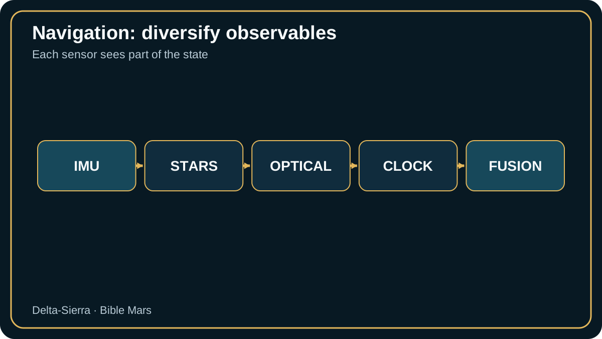
Observability changes with geometry
A star tracker constrains attitude, an IMU propagates motion, optical navigation provides line-of-sight information, and radio tracking constrains range or range rate. None provides the full state equally well at every moment. Navigation planning therefore schedules observations when geometry makes the weak state components observable.
Bias calibration is equally important. A tiny gyro bias integrated for hours can become a large attitude error; a camera boresight error can look like a navigation bias. Calibration parameters should be part of the estimated state when the mission needs to learn them in flight.
Graceful degradation means changing what the mission asks for
When optical navigation is unavailable, the vehicle may still continue safely by reducing manoeuvre complexity and waiting for another observation opportunity. Degraded navigation should therefore change operational goals, not merely display a larger uncertainty number.
Case study — make inertial drift visible
A constant gyro bias b integrates as Δθ ≈ b t. With b = 0.01°/h and t = 6 h, Δθ ≈ 0.06°. At 10 km, x ≈ Rθ gives about 10.5 m. b is angular bias per unit time, t duration, R range and x lateral error.
When stellar or optical updates disappear, uncertainty must explicitly begin growing again. An estimator that still displays a precise point without corresponding covariance creates dangerous confidence.
Tests alternate periods with and without external references and verify that actual error remains consistent with reported uncertainty.
A bias becomes dangerous when the trajectory cannot observe it
An inertial sensor bias integrates into velocity and position error, but the rate at which it can be estimated depends on external measurements and geometry. A star tracker constrains attitude; optical landmarks constrain line of sight; radiometric tracking constrains combinations of range and range rate. No single sensor necessarily observes every state at every moment.
Navigation design should therefore ask when each bias becomes observable. During long cruise intervals, a small unmodelled bias may grow quietly until an optical or radiometric update arrives. Filter consistency, residual trends and covariance growth are operational indicators that determine when a manoeuvre estimate is trustworthy.
Sources and references
Specialized sources — navigation and PNT
- JPL IPN — PNT architectures for Moon and Mars — investment priorities and Mars-specific architecture questions
- NASA — autoNGC — autonomous navigation and control
- NASA — CAPSTONE 2026 — autonomy and DTN demonstrations
Specialized bibliography — communications, navigation and autonomy
- JPL IPN Progress Report — PNT at the Moon and Mars — Architectures et priorités technologiques PNT lunaires et martiennes.
- NASA — autoNGC — Navigation autonome et planification embarquée.
- JPL — Deep Space Atomic Clock — Rôle des horloges dans la navigation autonome.
- NASA NTRS — Mars Planetary Network for Human Exploration Era – Potential Challenges and Solutions — Relais orbitaux et fonctions potentielles de navigation.